Remote sensing based Information and Insurance for Crops in emerging Economies (RIICE) has been applied over main rice production areas; the results demonstrate the system can be used in different ecosystems and can be extended at the national level. The information provided by RIICE has been also used for the implementation of a rice insurance scheme at Bao Viet Company for two provinces of the Red River Delta and can be expanded to other provinces in Vietnam in the coming seasons.
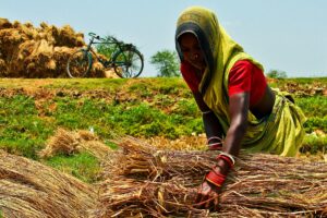
Rice production plays an important role in the agricultural production structure of Vietnam, rice yield and rice production are expected from the middle of the crop to have a consumption plan for farmers and managers. However, the cost for the actual investigation of the growth of rice takes a lot of time and human resources. Many researchers pointed out that remote sensing image data is suitable for agricultural monitoring in general and rice crop monitoring in particular in tropical regions such as Vietnam. Besides, with the strong development of predictive models, the estimation of rice yield has been carried out by many studies with both optical and Radar images.
Optical remote sensing image data has been widely used for the purpose of monitoring and estimating productivity in the world and in Vietnam; a model to predict rice yield and output in the Red River Delta using MODIS NDVI image data but affected by cloud. On the other hand, many authors have used radar images to monitor the time of sowing, according to which the strongest growth time of the crop is peak growth and index correlation. rice growth with photo.
Vietnam is one of the biggest rice-exporting countries. However, agricultural production is impacted by many risks due to natural disasters (storms, floods, droughts, and salinity) that cause many damages to farmers. Although agricultural insurance has been issued by the Vietnamese government since 2011, the mechanism and method of insurance implementation are still difficult, the implementation is thus still limited
To serve in agricultural management and support for insurance of rice, the Remote sensing based Information and Insurance for Crops in emerging Economies (RIICE) project started in 2013. This is a collaborative initiative between the International Rice Research Institute (IRRI), SARMAP (a Switzerland-based remote sensing company), Ministry of Agriculture and Rural Development (MARD), Vietnam and is funded by Swiss Agency for Development and Cooperation (SDC).
RIICE technologies rely on the integration of MAPcape-RICE® and Rice Yield Estimation System (RiceYES) softwares. MAPscape-RICE® uses the Synthetic Aperture Radar (SAR) to detect rice areas, the start of season (or planting) days, and the Leaf Area Index (LAI) while RiceYES uses ORYZA crop growth simulation model to provide spatially explicit yield forecast and end-of-season estimates at harvest time. Regular crop monitoring was made possible by freely available Sentinel-1 Synthetic Aperture Radar (SAR) data provided through the Copernicus initiative of the European Space Agency (ESA), every 12 days.
These images are not sensitive to clouds and are well suited to map rice crops, particularly in Asian countries where cloud conditions are an issue, particularly during the wet/rainy season. Though. rice monitoring activities in Vietnam started in 2013, the data that will be shown and discussed in the paper will be focused on the last three years of the dominant season.
For An Giang, Dong Thap, Nam Dinh, Thai Binh, Nghe An and Ha Tinh, the dominant season is the Winter-Spring while Summer-Autumn is the dominant season for Binh Thuan. This paper summarizes the methodological development carried out to produce detailed maps of rice area, start of season, yield and its application in insurance in the case study in seven provinces located in three regions of North, Center, and South Vietnam.
In this study, we presented the RIICE methodology and its application in Vietnam. Generated rice area and yield data using RIICE technologies are proven over the years (2013-2021) and as illustrated in the rice area accuracy (2016-2017) and yield agreement with the dominant seasons of 2018-2020. The technology has been applied over the main rice production areas; the results demonstrate the system can be used in different ecosystems and can be extended at the national level.
All the information is timely produced and delivered by NIAPP to MARD and is published through a dedicated web page and bulletins. The information provided by RIICE has been also used for the implementation of a rice insurance scheme at Bao Viet Company for two provinces of the Red River Delta and promises to be expanded to other provinces in Vietnam in the coming seasons.
Upgrades are essential and on-going both in terms of methodology refinements and in terms of new data. With respect to Earth Observation data, the availability of Sentinel-1 every six days everywhere would contribute to more precise detection of the SoS, crucial for yield modelling; very high resolution time-series data (technically viable but costly) would improve the rice area in scattered and fragmented rice ecosystems.
Concerning the yield component, key information which would improve estimates are the availability of real-time local weather data (current weather data used are derived from Climate Hazards Group InfraRed Precipitation with Station data), the integrationof a high resolution soil map and more detailed information on crop varieties and management practices. More systematic validation of yield assessment through crop cut experiments will also provide a regional dataset to facilitate the objective evaluation of crop modelling improvements.
Read the study:
Truong QC, Bui HV, Quicho Emma et al. (2021) Mapping and monitoring the rice crop in Vietnam: Experienced using RIICE technologies. Paper presented at the 42nd Asian Conference on Remote Sensing (ACRS2021) 22-24th November, 2021. Can Tho University, Can Tho City, Vietnam