Named after the twin river systems, the Indus and the Ganges, the Indo-Gangetic Plain (IGP) is South Asia’s major food-producing region that comprises parts of Pakistan, Nepal, India, and Bangladesh. More than one billion people—one-seventh of the world’s population—live in the IGP.
 With the ever-increasing population as the backdrop, the major challenges in the IGP are to satisfy the food demand of the people who live there and improve their livelihoods and to preserve its natural resource base.
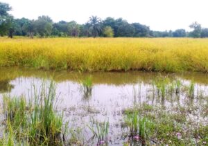
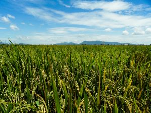
Large tracts of land in the middle and lower Gangetic Plains are either uncultivated or underused after the rice harvest during the kharif (wet) season, including ricefallows (under 6.7 million ha), flood-prone riversides (or diara lands, 2.4 million ha), waterlogged areas (4.9 million ha), and salt-affected soils (2.3 million ha).
Improved resource-conserving technologies, such as zero-tillage, can give farmers in these areas new ways to grow rice and wheat that increase productivity and profitability as well as input efficiency. But, different resource-conserving technologies suit different areas and it is not a case of one technology fits all.
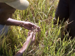
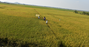
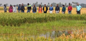
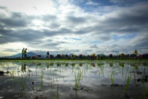
To make sure the right resource-conserving technology is delivered to the right area, it helps to know first the extent and distribution of these “problematic” lands (salt-affected soil or waterlogged areas). The International Rice Research Institute (IRRI) has done this by obtaining spatial information at the field or village level from high-resolution remote-sensing data. Once a problem in an area is identified, the technology that is most effective in overcoming the problem can be promoted and shared with local farmers.
 Studies conducted by IRRI and the International Maize and Wheat Improvement Center (CIMMYT) in the IGP show that remote sensing-based technology targeting can bring immediate impact and can provide more income to farmers. For example, farmers stand to gain a potential income increase of US$63 per hectare by targeting raised beds in salt-affected soils; $250 per hectare by introducing submergence-tolerant rice varieties (e.g., Swarna- Sub1 varieties); $800 per hectare by introducing boro rice (November- April) in waterlogged areas; and $581 per hectare by introducing zero-till when growing lentil in rainfed fallow lowlands.
Farmers can earn $147 per hectare by timely planting zero-tillage wheat. They could earn an additional $180 per hectare by growing a short duration mungbean crop after the harvest of drill-seeded zero-till wheat.
 Remote sensing-based technology targeting has an enormous potential to increase the efficiency of technology transfer and impact assessment. The methodology is already proven and can be applied to more than 15 million hectares of underused IGP lands. If precisely applied, all this can add an income of more than $3 billion each year to these poverty-prone areas.
____________________
Dr. Chandna is a remote-sensing and GIS scientist at IRRI-India; Dr. Nelson is a geographer and head of the GIS Lab at IRRI-Philippines; Dr. Ladha is a principal scientist and IRRI representative in India; Dr. Singh is a professor at Banaras Hindu University, India; Dr. Punia is an associate professor at Jawaharlal Nehru University, India; Dr. Gupta is a consultant at The Borlaug Institute of South Asia, India; and Dr. Sidhu is the director of the Department of Agriculture in Punjab, India.