The land around Pang Cang village of Suoi Giang Commune in Vietnam’s northern province of Yen Bai is steep. To give you an idea of just how steep, when the locals cycle down to Van Chan, 12 kilometers away, some of them hook a tree branch to the back of their bike to act as an extra brake. Some don’t even bother keeping a chain on their bikes—you either roll downhill or walk up. Riding uphill is not an option.
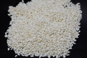
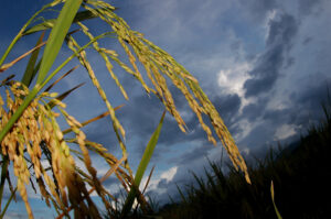
Seeing this terrain for the first time, one can’t help but ask: why on earth would anybody want to farm this land? On hills that most people would refuse to hike, people plant rice, maize, tea, cassava, soybeans, peanuts, and more. There is no irrigation for these sloping uplands; farmers rely solely on the wet-season rains that (they hope) begin in May or June. And these slopes are not farmed for their high yields. In some cases, 100 kilograms of seed produces a mere 800 kilograms of rice at harvest. The answer, then, is that nobody would want to farm here—they do it because they have no choice.
Not far away, in the agriculturally and climatically similar uplands of northern Laos, the situation is the same. Through a lack of alternatives, families are forced to farm land that sucks in everything that’s thrown at it—from seeds to arduous, spirit-crushing labor—and offers little in return.
“Who would do that if they had other options?” asks Sushil Pandey, senior agricultural economist at the International Rice Research Institute (IRRI). Dr Pandey, leader of IRRI’s Rice policy support and impact assessment research program, is leading two projects in Vietnam and Laos, as well as India and Nepal (see Who, what, and where on page 15). The research team is investigating ways of improving food security, reducing poverty, and minimizing environmental degradation in the uplands. His question is rhetorical. The point is that most people here don’t have alternatives. The only land they can use is on these steep slopes. With very little income, they have no choice but to eke out a living by growing their food here.
“What we want to do,” says Dr. Pandey, “is to help them develop options.”

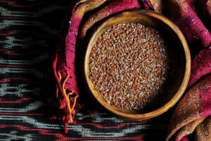
And the key that can unlock alternatives for the farmers is rice—specifically, increased rice productivity. Dr. Pandey sees producing more rice on less land, and with less labor, as one of the most promising entry points for breaking out of what IRRI calls the vicious circle and moving into the virtuous circle.
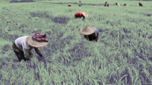
There are several key constraints to agricultural production and income for farmers on sloping uplands. Most visibly obvious is the unforgiving fragmented topography, which forces people to work on gradients of more than 25 degrees up to a backbreaking 45 degrees. The predominant mode of agriculture on these slopes is shifting cultivation—otherwise known as slash-and-burn farming. This involves farmers clearing and burning a patch of land on which they grow crops for a few seasons before leaving the land fallow and moving on to another patch of land. After a time, they return to the original area, cycling through as many plots of land as are available, and giving the mountainsides in northern Laos and Vietnam their distinctive green-brown-black patchwork look.
The endemic poverty in these areas means that farmers either can’t afford or are unwilling to buy basic inputs such as fertilizer. Living conditions are as austere as they come. Many people live in small huts with a few basic possessions—little more than some cooking pots and a few utensils. This tenuous day-to-day existence means that farmers in these unfavorable areas are risk-averse and either unable or reluctant to invest in technologies that may help them later.
The harsh weather—long, dry, cold winters and very wet, hot summers—is another major constraint. Pests and weeds are constant problems and weed management requires intensive labor (manually weeding flat fields is a thankless task in itself; imagine doing it in the scorching, humid summer on muddy, 45-degree slopes).
Compounding the problem of poor productivity is inadequate access to markets. Even if farmers do manage to grow a cash crop or a rice surplus, many farms are several hours along narrow mountain footpaths from the nearest place where they can sell their produce. The research, which represents IRRI’s strategic efforts to reduce poverty and improve environmental sustainability in uplands, focuses on managing rice landscapes in marginal uplands. The projects—partly funded by the International Fund for Agricultural Development (IFAD) and the Consultative Group on International Agricultural Research (CGIAR) Challenge Program on Water and Food (CPWF)—aim to develop, validate, and deliver technologies for poverty reduction through improved management of rice landscapes while also improving the way water is used in poor farming areas.
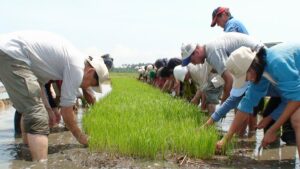
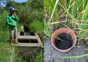
The “rice landscapes” approach calls for intensification of food production in favorable pockets of the uplands so that pressure to intensify production in the less favorable, more fragile areas can be reduced. These favorable pockets include productive wetland paddies in valley bottoms and terraced fields (or “upland paddies”) where irrigated rice can be grown. They also include dry terraces and fields with lower slopes that are better able to retain moisture and nutrients than the steeply sloping areas. Dr. Pandey emphasizes that, rather than being limited to the management of rice fields alone, these projects are about rice landscape management as a whole.