Rice is grown in more than 100 countries. According to the Food and Agriculture Organization of the United Nations (FAO), the global rice area harvested in 2005 was 153 million hectares. The amount of land used for rice is less, in the order of 127 million hectares, because in some fields farmers plant two, or even three, rice crops each year. One hectare of double-cropped land therefore provides 2 hectares of rice area each year (areas referred to hereafter are harvested areas, as opposed to actual land areas). On this land, farmers produce 628,000,000,000 kilograms of rough (unmilled) rice.This averages out to about 95 kilograms for each person on Earth.
Almost half the global rice area is in India and China and 89% is in Asia. Africa and the Americas each have a little more than 5%. The eight countries with the most rice area are all in South and Southeast Asia (India, China, Indonesia, Bangladesh, Thailand, Vietnam, Myanmar, and the Philippines) and they have 80% of the global rice area.
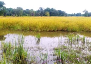
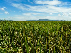
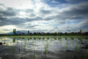
Rice production agroecosystems are often classified according to the dominant water regime. For example, rice fields are distinguished for being irrigated or rainfed, and for being flooded or not flooded. Irrigated rice, typically grown on bunded fields that retain water to assure flooded conditions, makes up about 44% of the global rice area. This is the dominant system at high latitudes (both north and south), but also in southern India and on the Indonesian island of Java. Flooded rice is the most productive rice ecosystem, producing about 75% of the global output.
Most of the rainfed rice fields are also flooded for at least part of the growing season. This agroecosystem, commonly known as “rainfed lowlands,” comprises about 45% of the global rice area and is particularly important in eastern India and Southeast Asia. The remaining 11% of the world’s rice area is grown in the “upland” ecosystem, which comprises fields that are neither flooded nor irrigated. In Asia, this system has declined considerably in Thailand and China, but is still important.
It is the dominant production system in Africa and Brazil in terms of area planted. The reality is always more complex, with fields that are sometimes flooded, or receive very little supplementary irrigation. In parts of northern China, for example, rice is grown as a “normal” (nonflooded) field crop, with supplementary irrigation as needed, while some of the upland rice in Brazil receives water from sprinkler irrigation. It remains a challenge to adequately characterize rice agroecosystems and obtain accurate statistics about their distribution.
The map on the next two pages reflects the International Rice Research Institute’s (IRRI) current best estimates based on subnational level production statistics in rice producing countries. While IRRI has a long history of compiling such data for Asia,1 the Institute now considers all rice-producing countries, in collaboration with the International Center for Tropical Agriculture, the Africa Rice Center, and the International Food Policy Research Institute. The map for Africa is a first approximation, and consistency between the classifications used in Latin America and Asia needs improvement. Meanwhile, the technology for this type of work is changing: a recent paper by Xiangming Xiao and colleagues2 has shown how time series of satellite images from the MODIS sensor can be used to map flooded rice areas.
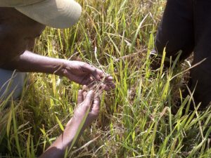
Knowing where and how rice is grown is crucial for assessing threats to and opportunities for production, and hence for determining research needs. For example, to estimate the possible impact of a drought-tolerant rice variety on income and poverty alleviation, you need to know (along with many other things) how much rice is produced in areas affected by drought, what the current rice yields are, and how much yield increase to expect from the new variety. Trends of detailed rice area and yield data can also help us better understand ongoing patterns of change, and the implications for food security and research priorities.
_________________________________________
Dr. Hijmans is a geographer in the IRRI Social Sciences Division.