Percentage of households buying rice, at any time of the year 2007, in communes of Madagascar. Rice...
Maps

The availability of water is a fundamental requirement for crop growth. In many places, rainfall is scant...

Cartograms are maps on which areas are altered to reflect the subject of interest. They accentuate patterns,...

Between 1979 and 2005, rice area in China decreased from 32.4 to 28.8 million hectares. At the...

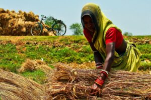
Rice is grown in more than 100 countries. According to the Food and Agriculture Organization of the...
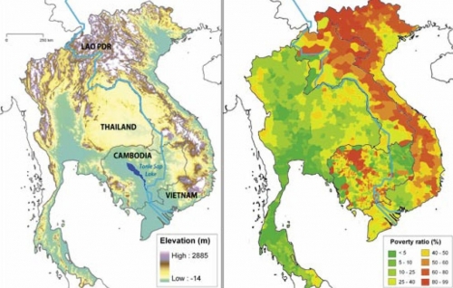
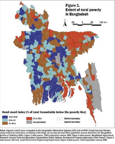
To develop effective poverty reduction strategies, we need to understand what the geographic patterns of poverty are,...

For this issue’s article on bird diversity and wetland conversion (see Balanced on a wing on pages...
Inequities in living standards limit the prospects for political stability and economic health wherever they occur. The...