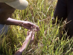
Recent advances in remote sensing are quite exciting. A case in point is the availability of high-resolution synthetic aperture radar (SAR) sensors on board satellites, such as the COSMO-SkyMed (CSK) constellation. These sensors can deliver precise and timely information about the status of rice crops to users in any part of the world.
SAR sensors differ from optical sensors. They can operate regardless of cloud cover and daylight, which guarantees observations of rice crops even during the monsoon or rainy season.
Regular observations at high resolution—with pixel size of only 3 meters—mean that all stages of a rice crop can be monitored at the field level and these images can provide useful information on crop management, crop production, and crop losses from natural calamities.
Figure 1 shows a composite of three SAR images between June and July 2012 of rice fields in Leyte, Philippines, from the RIICE project (Remote sensing-based Information and Insurance for Crops in Emerging Economies).

By assigning a color to each image, we can combine the red, green, and blue images into one color composite to show different rice planting dates. The blue field shows the area covered with water on 25 June and 11 July, meaning that planting occurred in mid- to late July. The red field is one that was under preparation and flooding in July and then was planted in early August. Gray areas are those where there is no change—light gray or bright areas are built-up or urban areas, gray tones are natural vegetation or other natural land cover, and black is permanent water. The inset map shows the level of detail that can be achieved with individual plots clearly visible.
 Different dates of rice planting over a small area indicate irregular irrigation in general, which has implications for pest and disease management and can potentially lead to higher management costs and/or lower yield.
With these maps, we can suggest priority areas for irrigation maintenance or rehabilitation, and give advice on how and where to promote more effective and efficient crop management.
Changes in rice area from one year to the next or crop damage due to calamities such as drought, flood, and typhoons can be monitored with SAR imagery, which can provide governments, disaster response agencies, and crop insurance companies with accurate and timely information.
For long-term goals such as rice self-sufficiency, reliable statistics about rice area (Fig. 2, right, click image to enlarge) can support national and regional decision making. IRRI is collaborating with Philippine Rice Research Institute (PhilRice), GIZ (German Agency for International Cooperation), Allianz, and sarmap to develop rice information systems for such stakeholders.
_________________________________________
Acknowledgments: We thank e-GEOS for the provision of COSMO-SkyMed imagery and the RIICE consortium partners—PhilRice, sarmap, GIZ, Allianz,and the Swiss Agency for Development and Cooperation (SDC)—for conducting and supporting this work. All images were generated with RICEscape (sarmap). See more information on the RIICE project at www.riice.org.
_________________________________________
Mr. Skorzus is an IRRI M.S.thesis scholar and GIZ intern and Ms. Garcia is a researcher and cartographer in IRRI’s GIS laboratory.
Mr. Bacong is a science research analyst at PhilRice.
Mr. Collivignarelli is a remote-sensing specialist for sarmap.
Dr. Laborte is a postdoctoral fellow and GIS specialist.
Dr. Nelson is a geographer and head of the GIS laboratory at IRRI.